All that is gold does not glitter, Not all those who wander are lost
5/29/2011
Hot Springs, South Dakota to Cody, Wyoming
I hadn’t planned for rain. My tent was old and though we tried to waterproof it since the last fiasco when I hiked the Appalachian Trail with Rachel Wallace, but apparently it hadn’t quite done the trick. I didn’t wake up to thunder or lightening or the sound of rain pelting the side of the tent, I woke up to the torture of water droplets slowly pelting my face from above. Everywhere else my sleeping bag had reliably kept me warm and safe, but now as I looked around, I found all of my scattered maps soaked, my pillow the same consistency as a soaked sponge, and my book twice as thick as it was when I had fallen asleep beside it. Thank god my computer had been out of battery as it was more safely tucked away in my book bag in the center of the tent. I folded and covered everything as best I could by the light of my tiny LED flashlight, but alas it was 4a.m. and I was not moving. The inside of my sleeping bag and I were still dry and warm and so I quickly fell back asleep. I would deal with this shit in the real morning. Several hours later with the rain still not letting up, water finally seeped into my sleeping bag’s one weakness: the zipper. My feet were right at the edge of the tent and now thoroughly soaked. Fine universe, I’m awake.
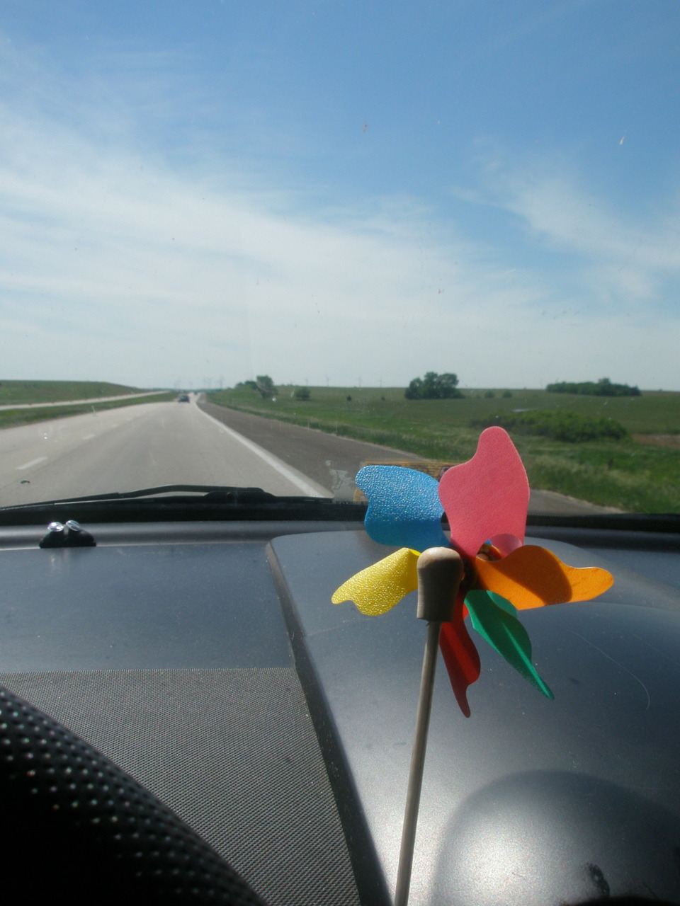
Accustomed to the warm temperatures of summer, I was still wearing a short-sleeved t-shirt, capri jeans, and (now soaked) flip-flops from the previous day. I tried not to shiver as I threw everything into the car. I lifted the stakes to the useless rain tarp and stuffed it haphazardly into the bag. Immediately the wind picked up the rest of the tent and tossed it against the nearby metal bench. I tried to step in, but I could no longer feel my fingers and was no match for the 1-2 punch of this wind and rain. A crack rang out across the camp (at least to my ears) and the apex of the tent now featured a splayed wooden rod. And thus the quite eventful life of this tent came to a close. I still sat there and painfully continued to take apart the tent so that I could shove it into it’s bag. Finally finished, I threw it into the back of the bug and then just sat in the front seat, refusing to move until the heat came on and the feeling in my fingers returned. I glanced at the temperature reading my car so kindly provides: 41 degrees. Great.
Today is still five-stops-in-one-day day: Wind Cave National Park, jewel cave, Crazy horse monument, Mt. Rushmore, and Badlands National Park. They’re all *kind* of in a close South Dakota/Wyoming cluster and I’m running out of time.
The campsite didn’t have running water, so I drove to the visitor’s center and hauled in a bag of clean, dry clothes. I changed quickly, but waited until everyone was gone from the bathroom to wash my face and brush my teeth so I didn’t look like the hobo I actually was. Just at the finish line, a park ranger walks in and attempts to hold a conversation with me. I quickly spit out my toothpaste and continue the conversation, but alas I am caught. Yes world, I am living out of my car. She thought it was hilarious, said she’d seen worse, and we walked out together. She signed me up for the official wind cave tour and soon I was in one of my favorite places: a dark, claustrophic, cave, situated out of the wind and rain (finally). The cave itself is incredibly unusual. Instead of being formed by running water, it was essentially a big underwater lake. The stagnant water allowed for the limestone that was eroded away to form a hard calcite shell within the cracks of the remaining limestone. Thus, when the water just kind of drained out of the cave, these square calcite deposits remained. The technical term for these is boxwork and this cave alone holds the majority of the world’s specimens on top of being one of the largest caves in the world. The lack of the normal stalactites and stalagmites and other running water formations made this cave a little boring, and my co-tourists were a little annoying with their constant “why would anyone willingly explore this place?” ( – umm cause its really cool guys).
I stamped my book and left for the next stop on this five-stops then lots of driving day. Driving to the next destination, I suddenly got cell service for a few precious moments. During which I listened to a voicemail from Lydia, bemoaning that I had left my laptop charger at her apartment. Ugh. Great. Oh well, it would have to be shipped to me in Idaho. In the mean time, without my mapquest source, (soaked) paper maps will have to guide me the rest of the way.
Jewel cave is apparently much prettier than wind cave. Obviously from the title, it’s a little more showy, more sparkly, and therefore more tourists were attracted to it on this rainy day – leaving zero tickets left when I arrived. I stamped my passport anyways and moved on to the next stop.
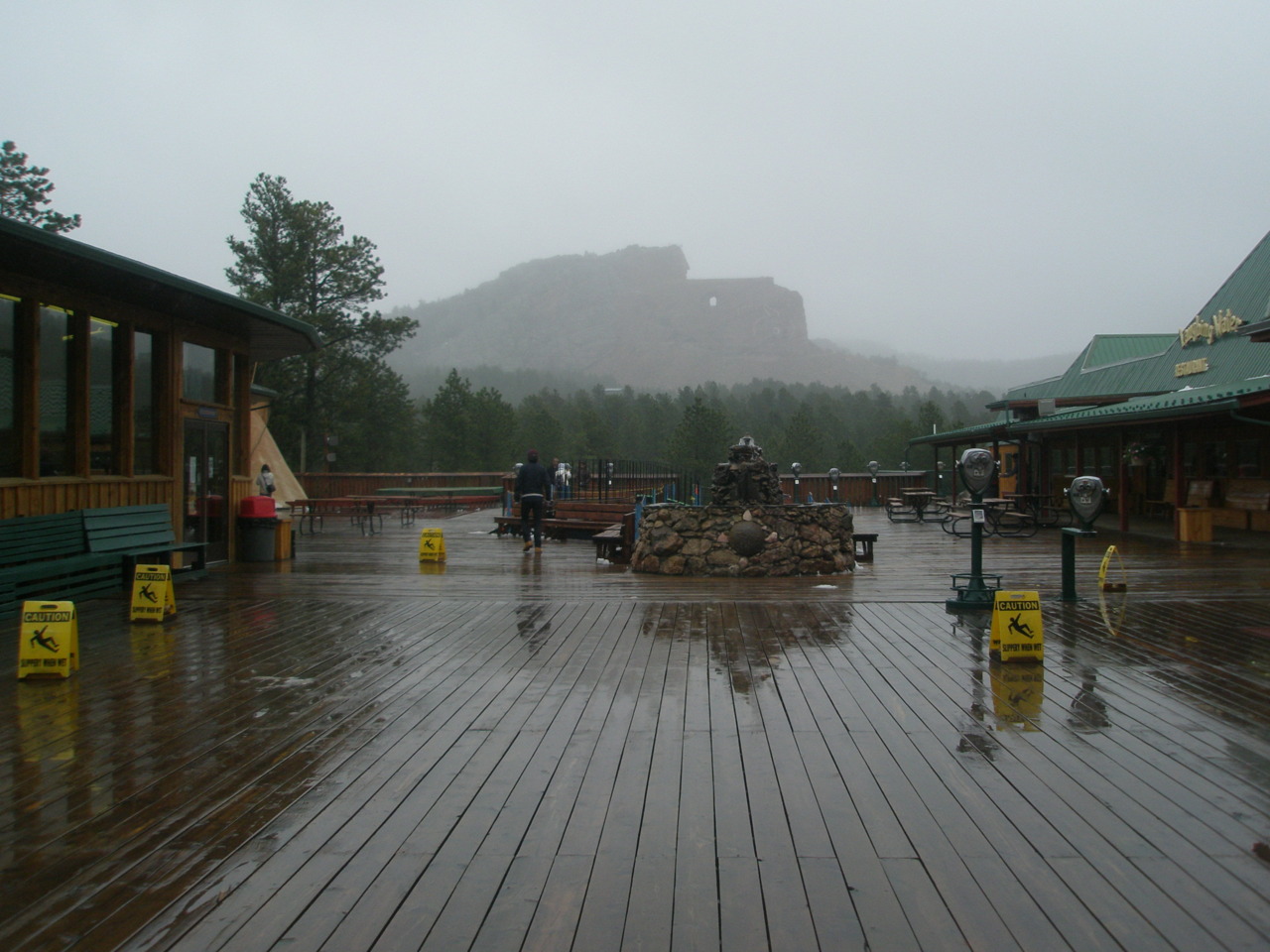
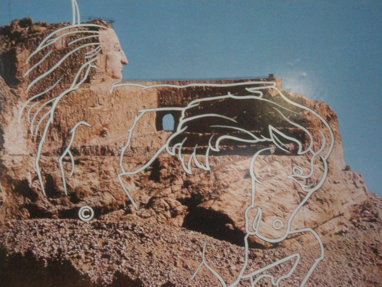
The Crazy Horse monument is certainly interesting in theory. Struck down early in life for his cause, he is supposed to be depicted atop a horse, windswept hair atop both heads, with Crazyhorse pointing out over his lands, in a monument that would be bigger than Mt. Rushmore. But the carving began in 1948 and you can still only see Crazy Horse’s face. On top of this the intro documentary thing had a sort of political rant on not accepting government money. And finally on top of this, the history of the mountain carvers is a little strange. The original carver, Ziolkowski (who also worked on Mt. Rushmore), died in the 1980s, but his work has continued through his wife and ten children’s efforts. That’s right ten children: five girls and five boys. The boys work on the mountain and the girls cook and run the gift shop. I don’t know why I found this so…strange…but I didn’t like it. Probably related to the political rants, slow progress, and very defined gender roles – meh. The museum itself was a little showy but very fascinating and the gift shop was filled with interesting things that I couldn’t possibly afford. The rain made it a little hazy, but I snapped my picture of this unfinished rock slab.
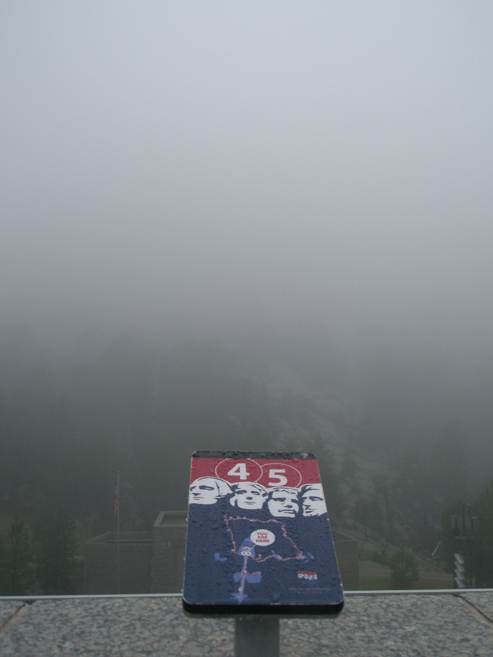
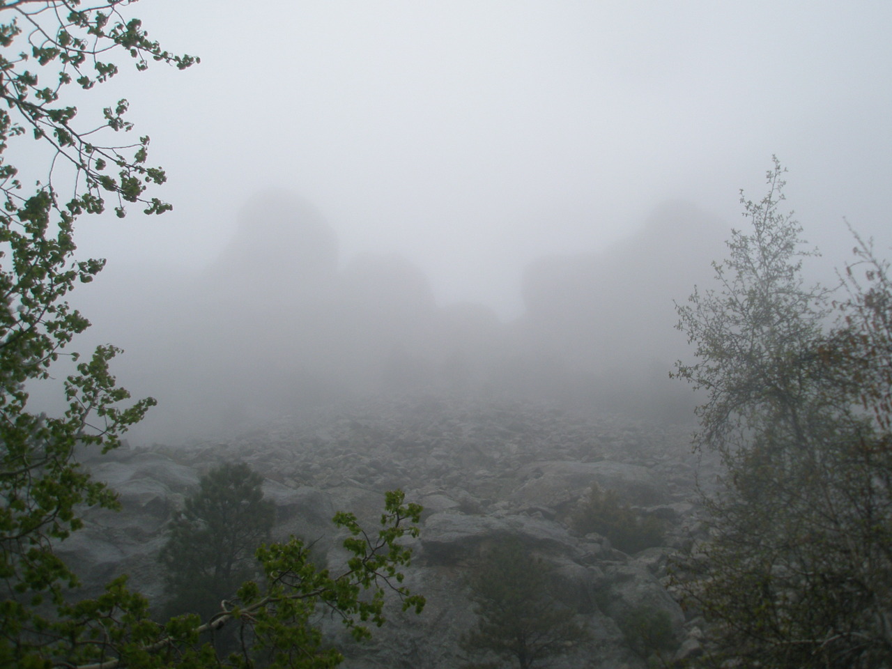
The rain maintained its constant drizzle as I headed further up the side of the mountain. As I climbed higher, a hazy fog set in, greatly reducing the visibility. For some idiotic reason, I did not pay attention to this, as I could still see the road and that was all I needed. I pay the admission fee for Mt Rushmore, march up to the observation deck, and then laugh awkwardly loud. It wasn’t there. There was a plaque explaining details of everything that should be in front of me, but there was just fog. I couldn’t even see an outline. I went back to the gift shop to buy some postcards to pretend like I had seen it, and struck up a conversation with the retired navy guy ringing me up. Apparently, I should join the military. I smiled, shrugged my shoulders, thanked him for his service, and listened pleasantly to another round of grandchildren stories. When he got more customers, I politely left, stamped my passport, watched a documentary, and followed a ranger on a hike to get a closer view of the monument, just in case. The fog did clear slightly, but only enough for me to see the outline of Washington’s head. The small children running about kept staring at the adults, wondering why they kept trying to see a big rock that wasn’t even visible. It’s kind of a shame I didn’t get to fully see it, but the ticket is good for the entire year so maybe I’ll make it back – but probably not, oh well.
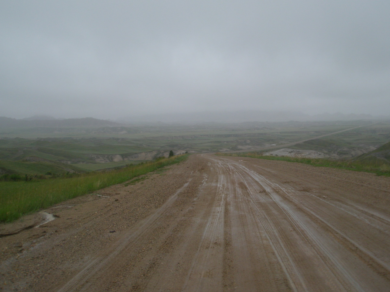
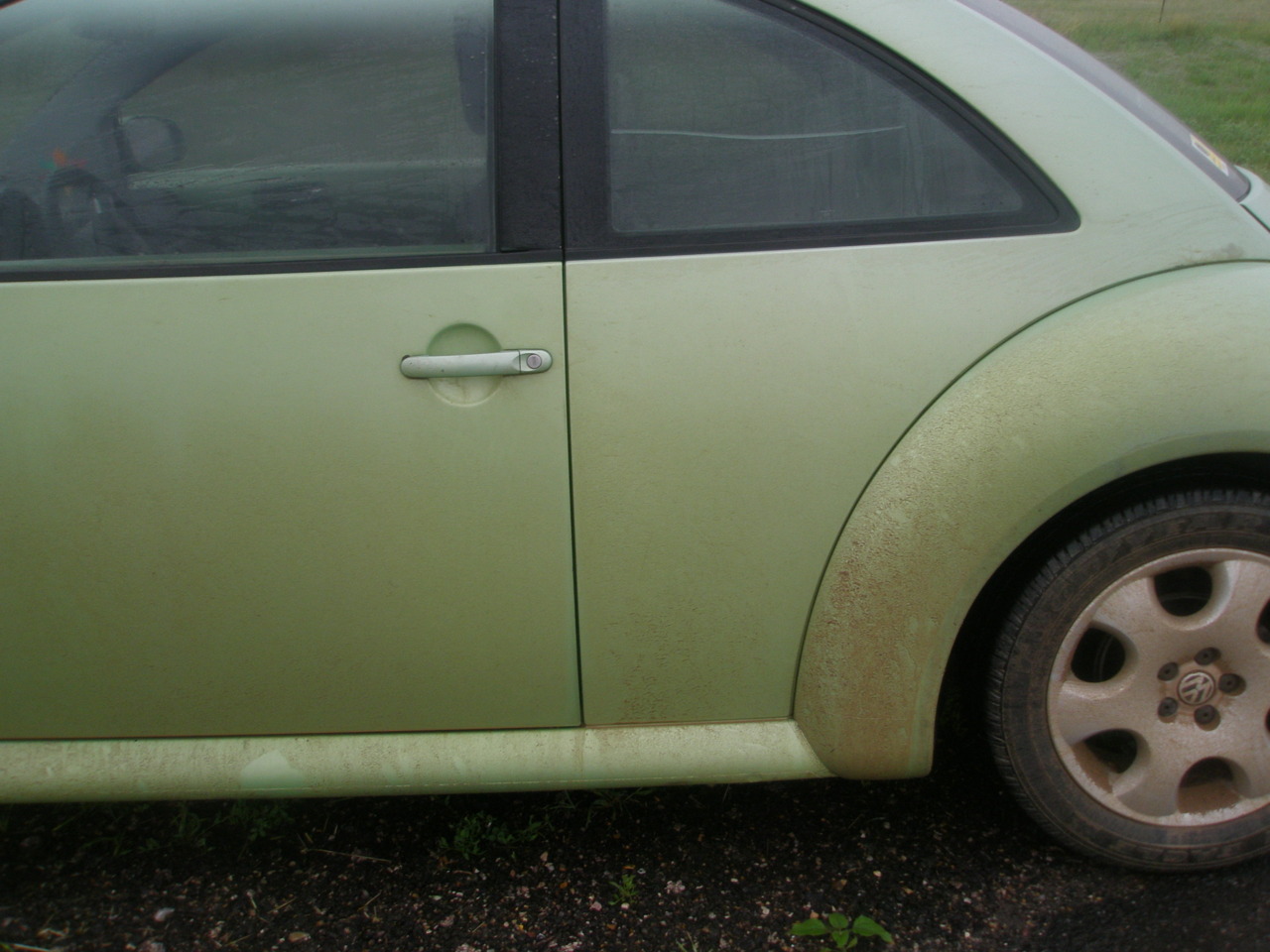
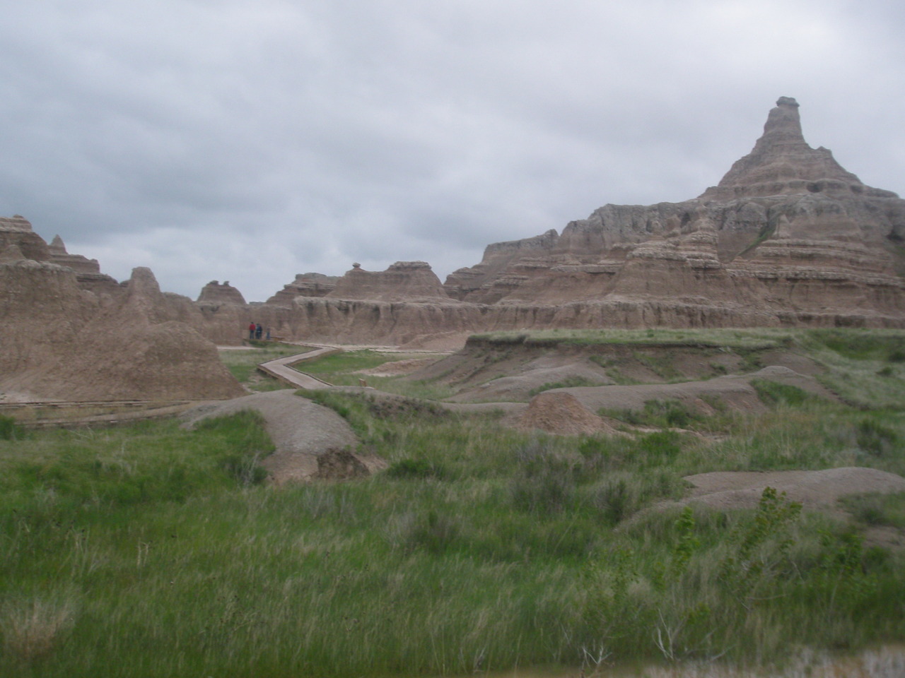
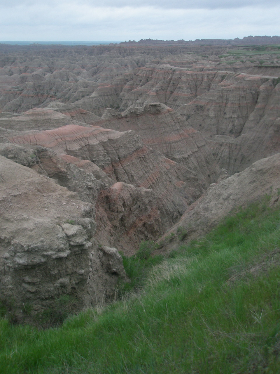
The final stop of the day was the badlands of South Dakota. The badlands are only an hour from the Mt. Rushmore area, but on the nice local map they pass out to everyone, they’re on two separate squares. With a little maneuvering I found a route that had the least mileage, brought me through the most area of the badlands, and avoided the highways. About halfway along this route, the paved road suddenly ended and a dirt/gravel road took its place. I was not aware of this upcoming shift and almost lost complete control of the car, slamming on the breaks and twisting from side to side as if I was driving on ice. I regained control and came to a stop in the middle of the road, heart pounding, making sure I still had all my limbs. Apparently “avoiding highways” is not the fun side road of the east coast but instead a freaking dirt road which shouldn’t even count as real road. But I couldn’t turn around now, I was already behind schedule and halfway there, so I buckled up (figuratively of course) and cautiously continued driving. The nightmare of getting stuck in the mud with no cell service pervaded my mind, but I brushed it away and continued on, rolling up the windows as the tires constantly splashed grime at my sides. The thrill of it all was kind of exciting and I couldn’t wait to see the badass dirt on the side of my car proclaiming that my bug – not a jeep or truck or SUV – had just off-roaded. I didn’t run into any people (though can you believe there were mail boxes on this non-existent road?) nor Buffalo (ugh!), but the scenery was absolutely beautiful. An hour or so later I returned to a paved road and the visitor’s center. It was 6:15 p.m. and the sun was beginning to set, so I quickly caught the last documentary showing, stamped my passport, admired Buffalo postcards, breathed in the air and sights around me, and headed back to the road.
There were two things now weighing on my mind. I no longer had a tent which meant I needed to find a hostel or hotel. Hostels were out of the question as I had no computer to look one up nor were there really any cities that would have had one anyways. So a hotel. Most hotels require that you be 21. I am 20. But maybe I talk my way (desperately pleading and looking pathetic) into one. The second thing was that I was running out of time. I had two days to get to Boise and there were numerous National Parks along the way that I wanted to stop at, including Yellowstone and Craters of the Moon. So, no longer inhibited by the need to set up camp during light, I decided I would drive toward Yellowstone for as long as I could stay awake and then get a hotel room.
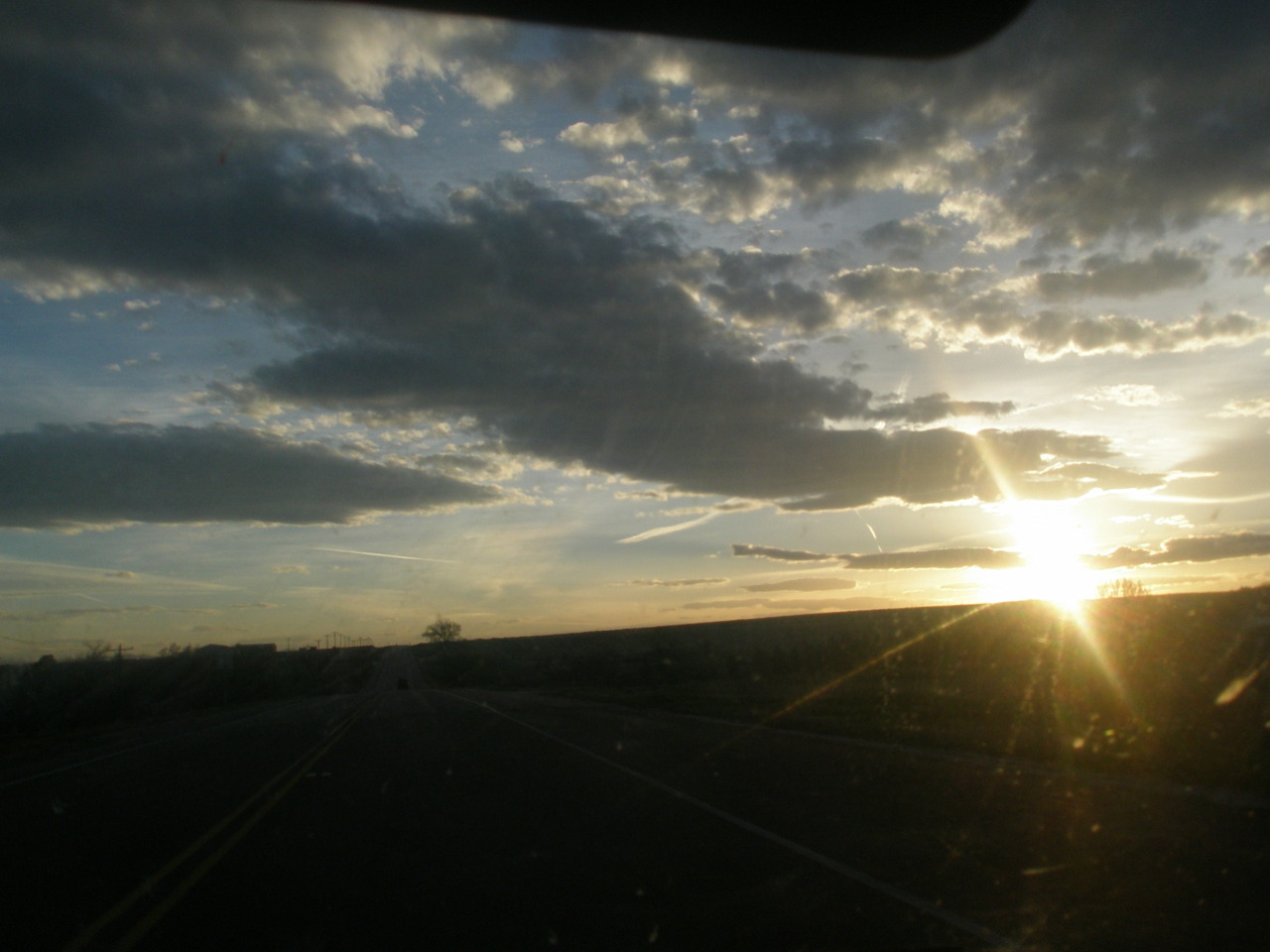
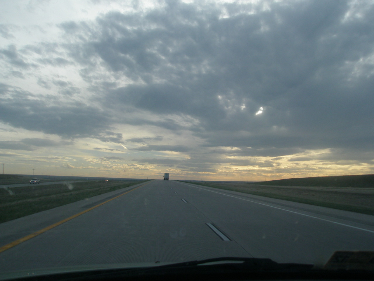
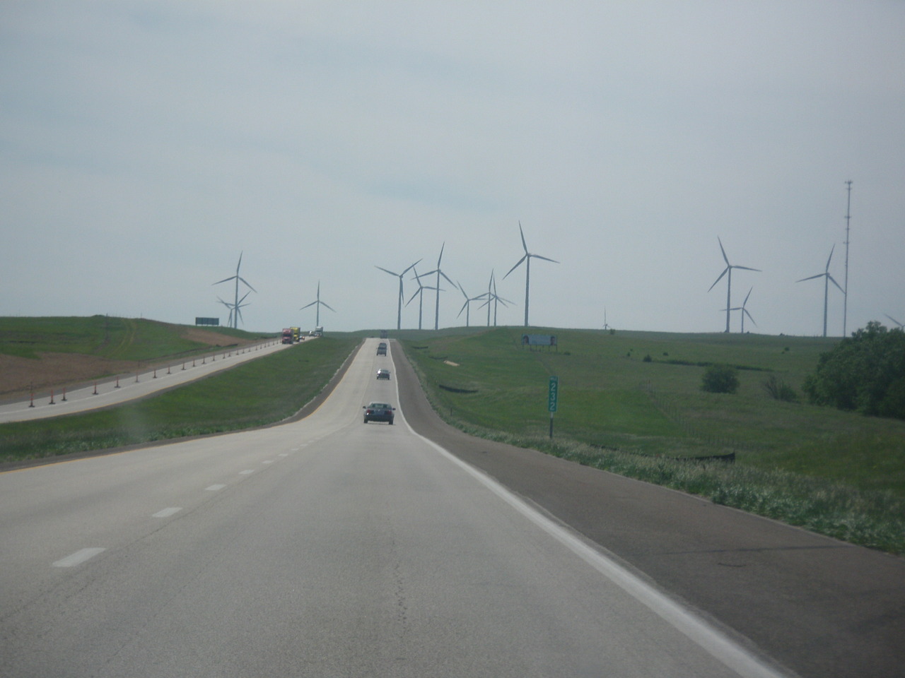
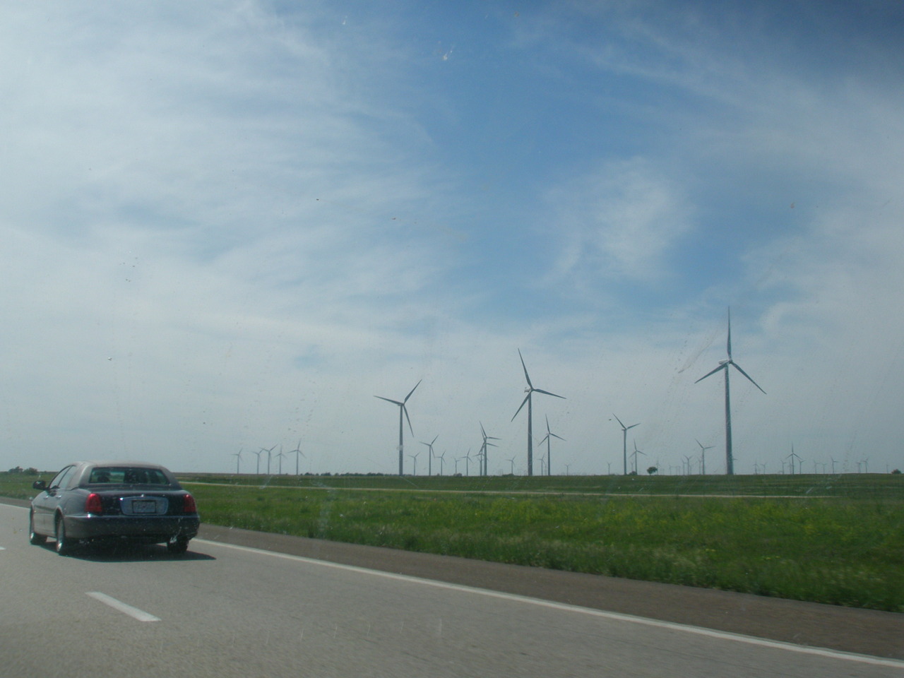
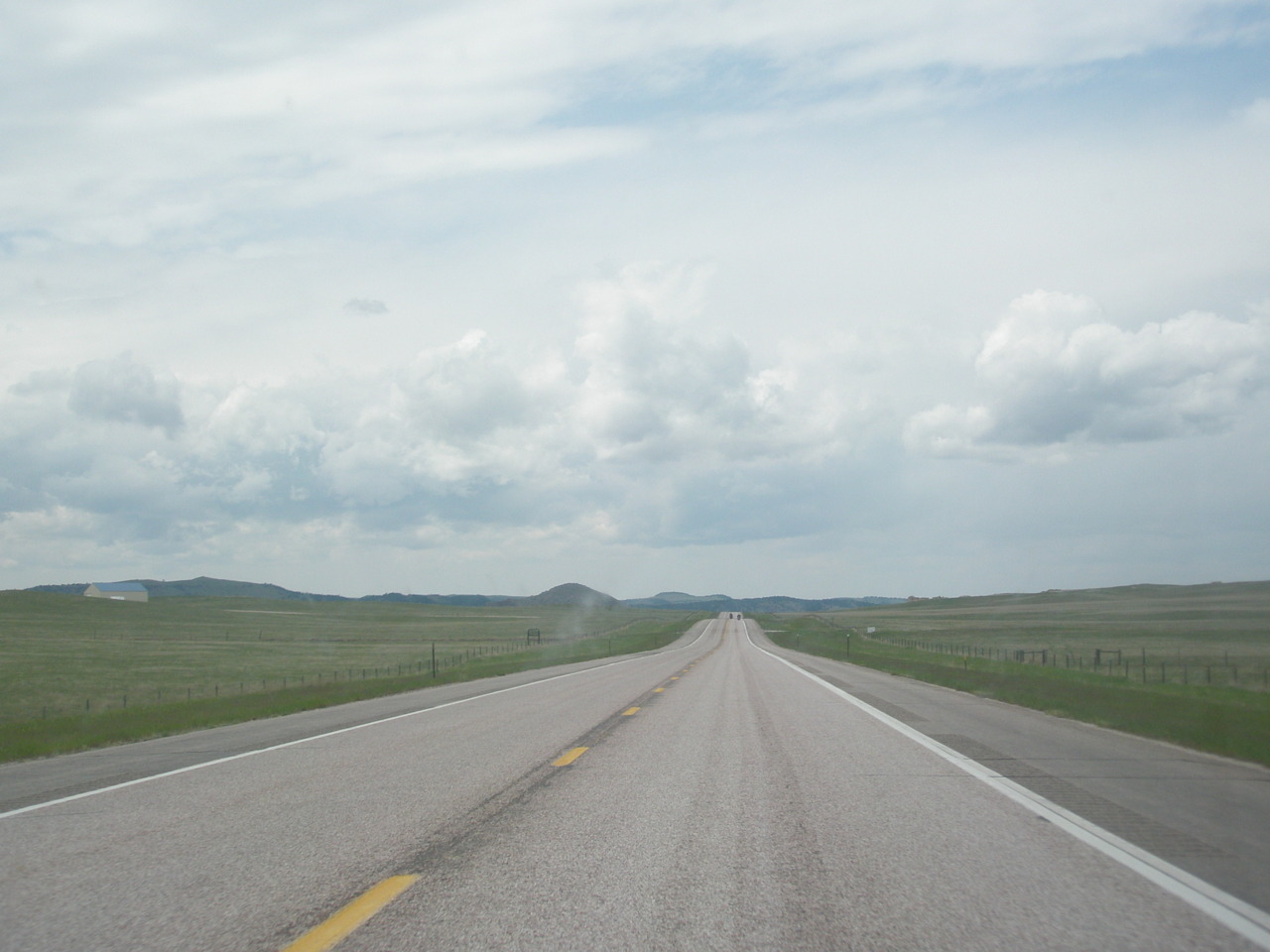
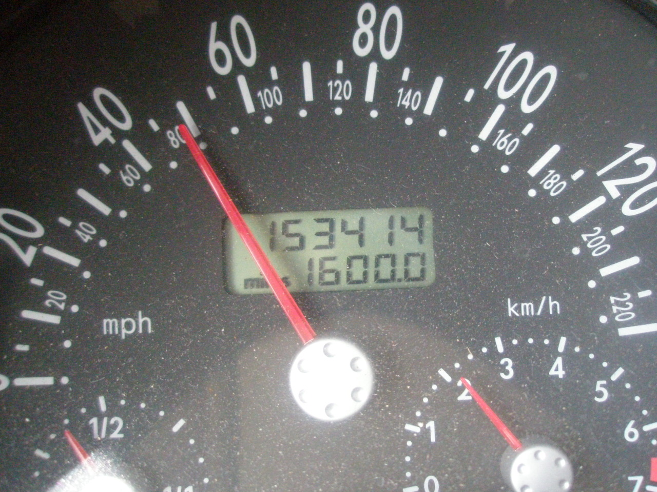
For some reason most of the places I stopped at today offered free coffee. Now I normally don’t like coffee at all, but this was both free and warm, so I probably drank maybe 6 cups throughout the day. In any event, I was wired, fresh off my dirt road success, and ready for another challenge. So I started driving. The rain continued throughout, but the fog came and went. Just when I was about to pull off the highway because I literally couldn’t see from this fog, it would clear and I would think to myself – ok, I can go for one more town, it’s just so close. I kept a constant watch on the temperature outside to make sure the rain didn’t turn to ice, but it held at around 42 degrees. But then I took it too far. The next town that looked so close on the map was actually on the other side of a mountain. The road became smaller (though still paved, thank god) and started winding back and forth up the side of this thing, like I was on the polar express. I tried to stay calm and imagine dancing men pouring me hot chocolate, but then my temperature indicator dropped to 32 degrees and the rain turned into sleet and then to snow. I have driven through snow once before in my life and that was in a mini-van in the middle of the day in a city. But I couldn’t turn around; I must be almost there, right? Nope. It was now dark, about 2am, no other humans were on the road, and the snow in my high beams made it look like I was going warp speed on the Enterprise, though I was crawling at 20 miles an hour. Though I couldn’t really see, the snow on either bank of the road rose to several feet and the pines, as tall as skyscrapers and as dense as sardines, looked like those fake, bright white trees in A Charlie Brown Christmas. WHY DO THESE MAPS KEEP SENDING ME DOWN CRAZY ROADS? A little scared, I was more focused on overcoming this mountain, and several tense hours later I emerged from the ski resort and snowmobile crossing areas intact. It was now 4 a.m. and I was exhausted, but the first town I came across had neither an open hotel nor some bright-lit convenient store where I could safely rest in the parking lot. So I traveled on. I finally arrived in Cody, Wyoming where there were no open hotels, but there was a 24/7 McDonalds. I parked in front of the drive-through, pretending like someone would be able to keep track of me in such a high traffic area and fell asleep in my reclined front seat.
5/27/2011
Colorado Springs, Colorado
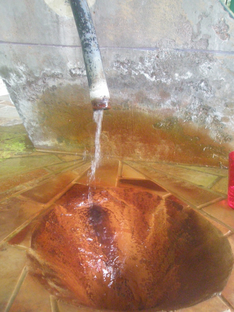
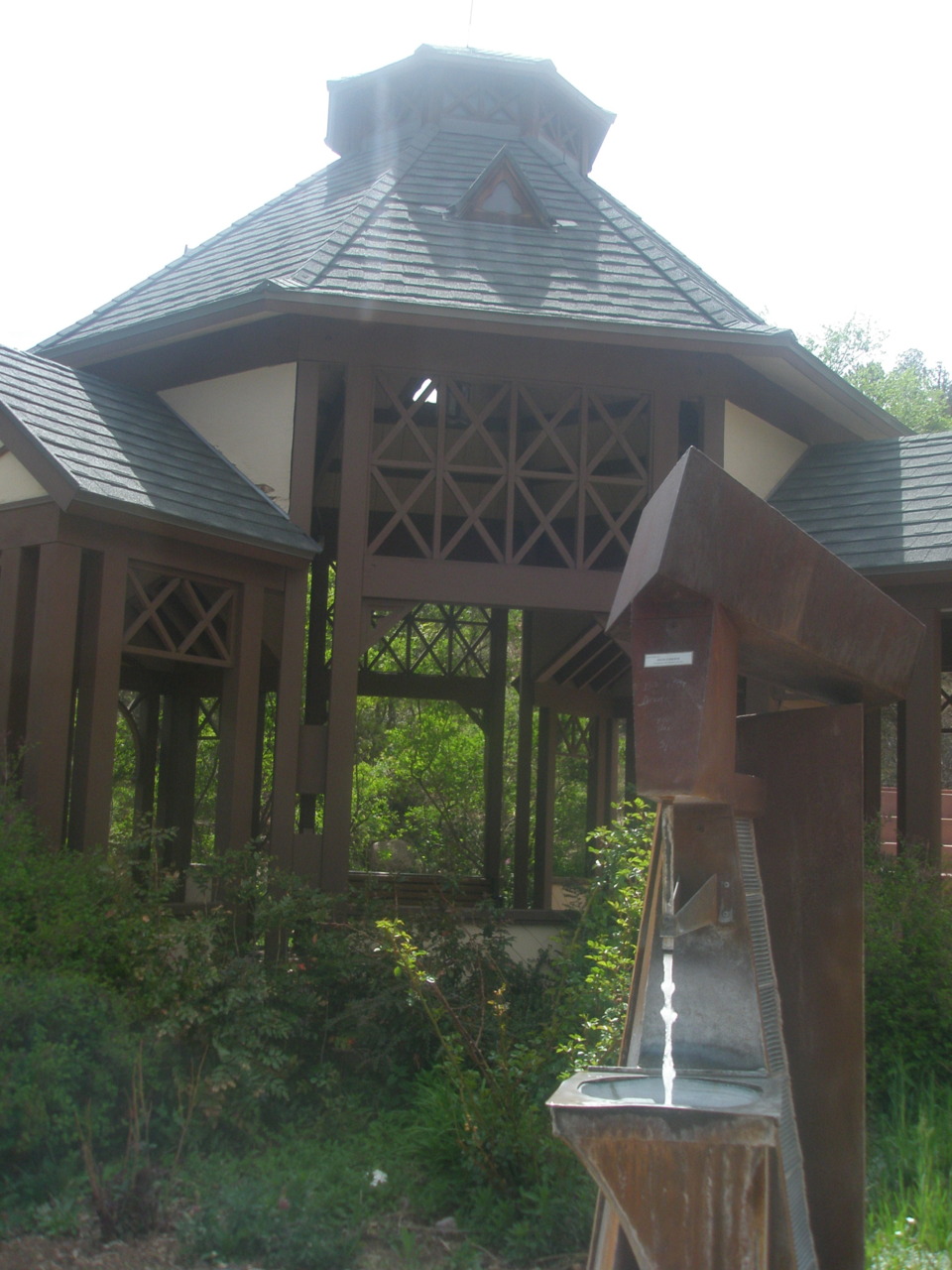
Having arrived so late and figuring the next leg of my next journey would be another 8 hours, I decided to spend the day in Colorado Springs and tour the town (Lydia’s pleading also helped a little with this decision). I woke up at 9 and peacefully read and fooled around with pictures on my computer until Lydia was awakened by a phone call. Lydia’s sister’s husband Nestor’s (ok so my second cousin in law??) car had broken down. His cursing Spanish amid rapid broken English radiated over the speaker and soon Lydia was calming him down and we were both out the door to the rescue. We picked him up, called several people, consulted a few mechanics, attempted to drive the car only to have a piece of metal drop from the bottom (never a good sign), and finally got a tow truck. Lydia was cool-headed the entire three hours as I watched from the back seat, more entertained and grateful for my own car’s reliability thus far, than bored. Lydia loaned him her car and I became the driver for our tour of the city. Despite my alarm going off every time I turned the car on (now for real this can’t be my fault every time) and me stalling on the side of a hill during a hairpin turn, the drive was quite nice. We drove through a blur of sites like Old Colorado Springs, Manitou, a kind of cultural/artsy downtown area, Miramont Castle, and the railroad car station that takes you up to Pike’s peak (a day’s journey I didn’t feel was necessary). We had stopped by the visitor station and gotten both a map of the local streams with a breakdown of their chemical components and a handful of tiny samples of locally made smelly-good lotion. In most places of the world and even the U.S., they warn against drinking water from the tap, let alone directly from a stream. Here, they pass out cups for just that. So throughout this tour we would stop at a random spot and stick our cups under an artistically designed spigot. The water was carbonated and not really my style but still really interesting just the same. The differences in iron you could especially taste. Having just finished a watershed class where we talked a lot about the chemical components of streams, I tried to analyze the water a little bit, but soon settled back into the summer mindset of forgetting everything I have ever learned.
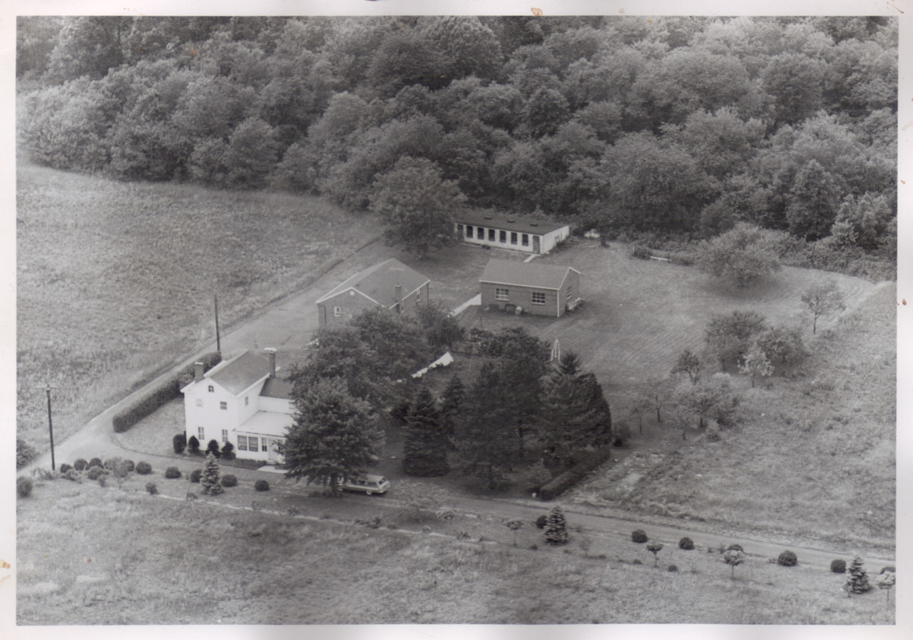
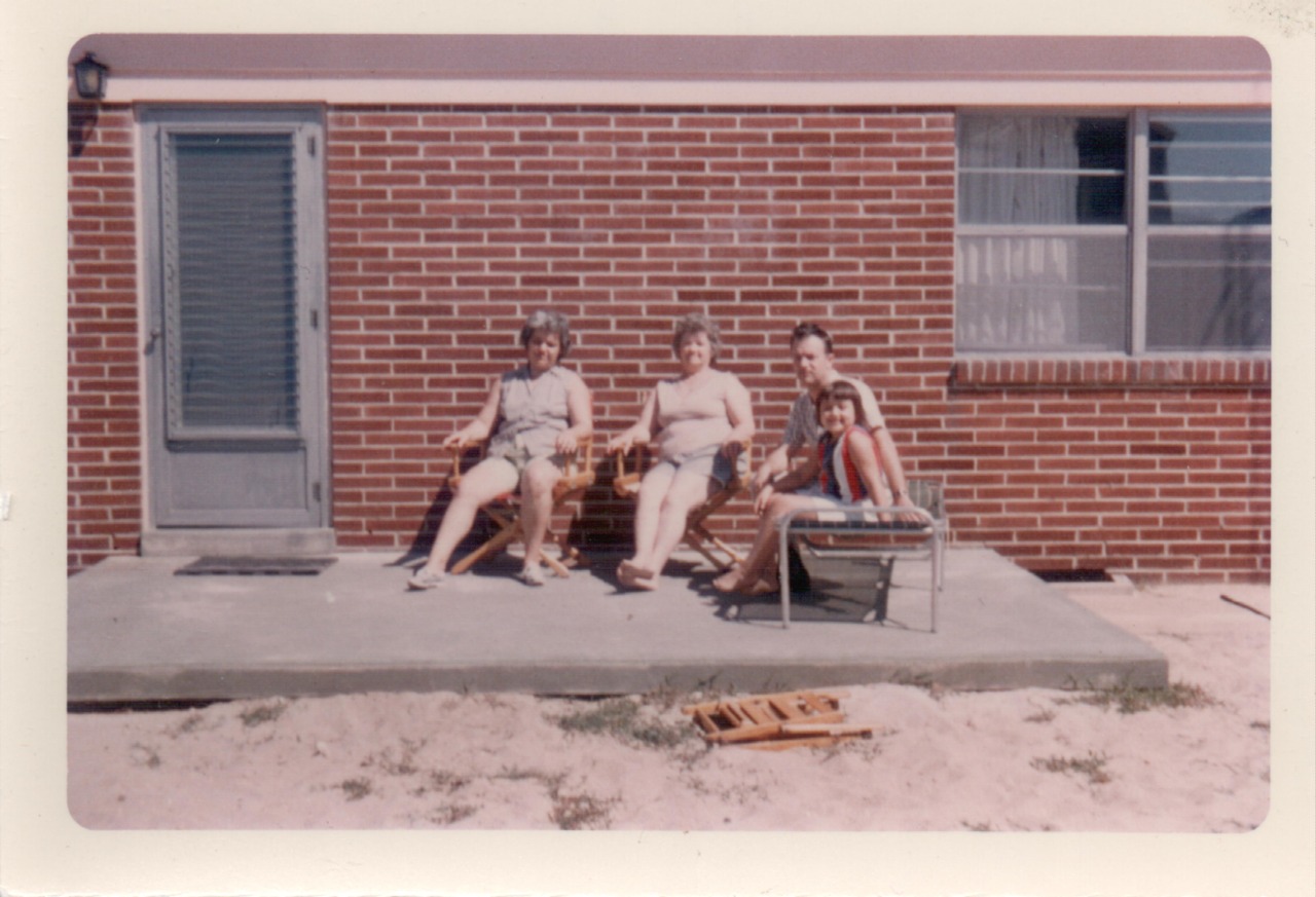
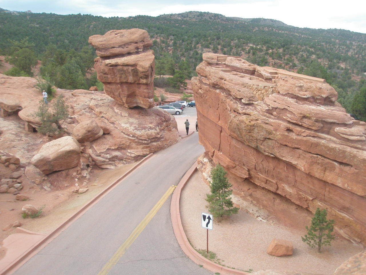
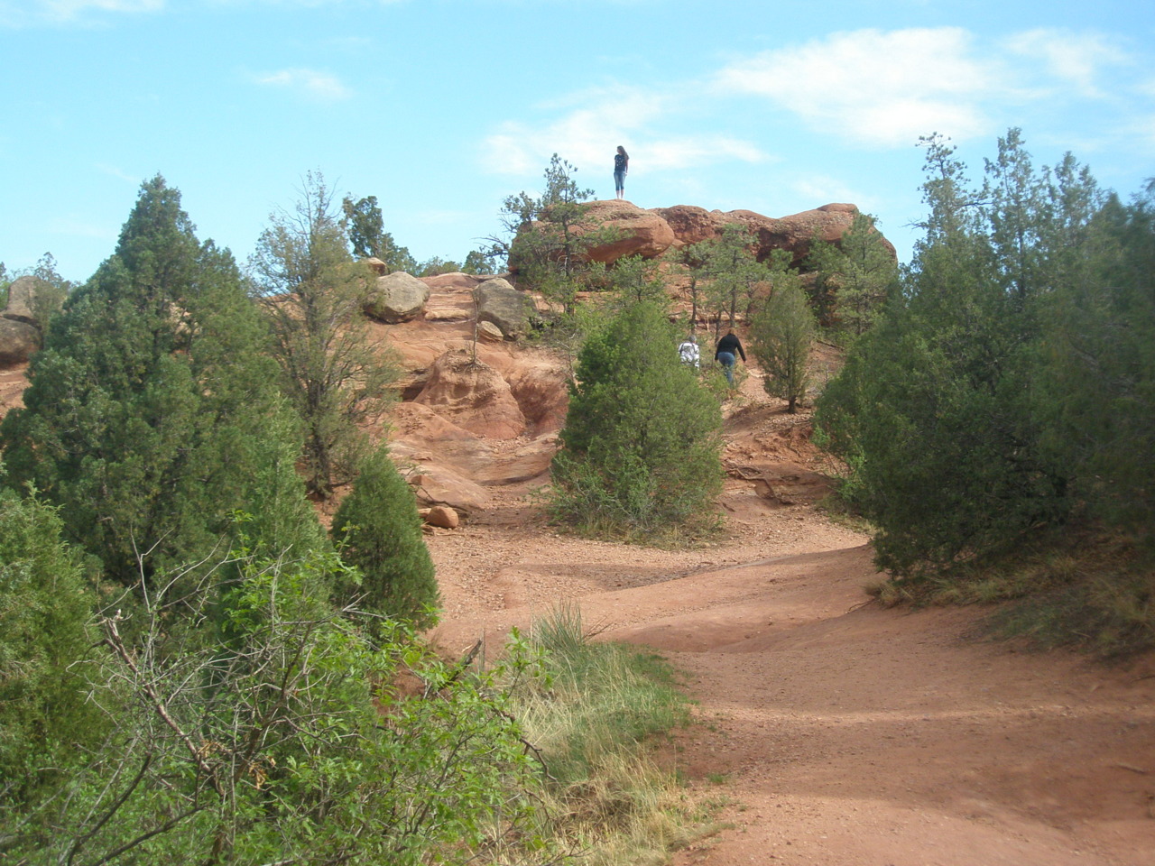
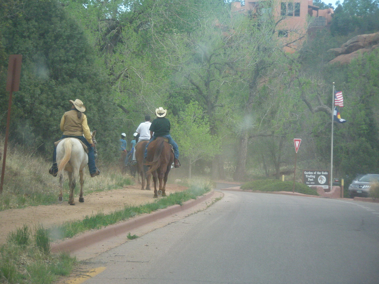
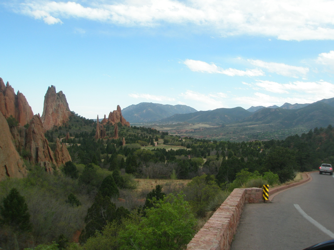
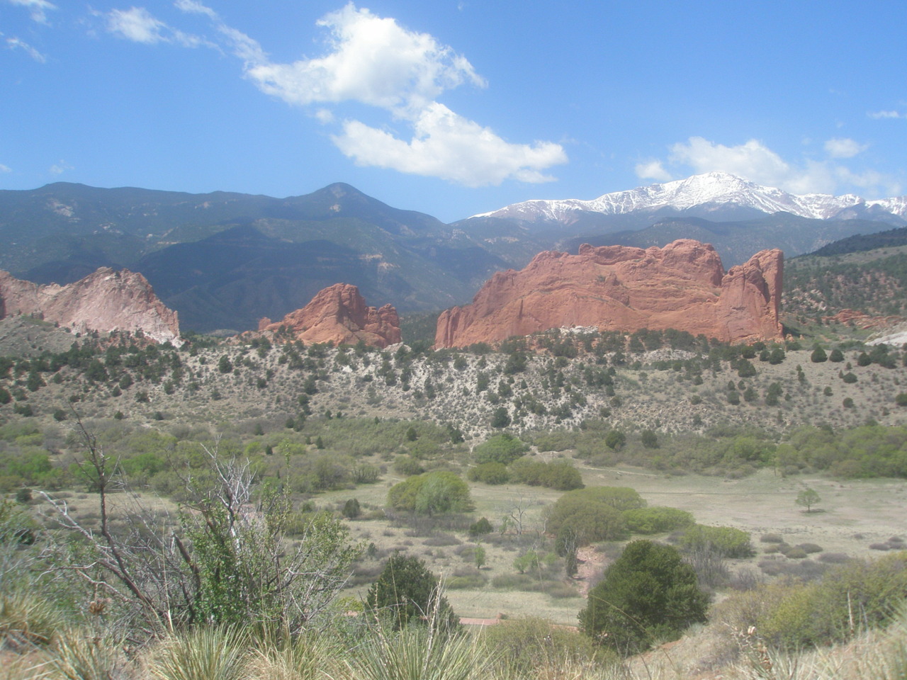
The thing to see in Colorado Springs is Garden of the Gods. My grandmother begged Lydia to take me there, but honestly, Lydia would have taken me there anyway. The city park is filled with a curving road for driving tourists as well as side trails for bikes, hikers, and even horses. The ground is somewhere between grassy and desert, with majestic terracotta/burnt sienna (yes, I am familiar with my crayon colors) towers of rock jetting out toward the sky in noteworthy shapes. One rock is called kissing camels, another balanced rock, and yet another steamship rock. I was enthralled with climbing and exploring, slightly upset I didn’t know geologic terms off the top of my head, but overall just engrossed. Having thoroughly driven throughout the park, the sun was beginning to set, and we were getting hungry from the long expedition, so we headed home. Back at the apartment, Skippy’s son Joey (are we on third cousins now, or am I just making things up?) joined us for pizza and cinnasticks as a reward for bringing over a new DVD player for Lydia. Amongst other dinner table discussions, Joey and I decided there was evil in the world because not everyone can go to art school. We also discussed everything Lydia and I had toured that day and as a final hurrah Joey decided to take me up to the side of the mountain. I had another moment of camera failure (I had brought the camera but the memory chip was still in my computer), so you’ll have to take my word for the scene being just gorgeous. If the sky had been clearer, the city lights would have looked like a reflection of the brilliant stars above. Joey did his best to explain the geography of the city to me through the use of “blinky lights” (the technical descriptor of course) as markers. We drove up the side of the mountain until we came to a dirt road, and then just kept on going. The road was thin and probably very steep on either side, but Lydia had assured me that he was a good driver before we left, so I gazed out the window, lost in thoughtlessness. We stopped by Helen Hunt falls on the way down and drove to more of Joey’s old high school hangout places, armed with ice teas from the gas station and discussing music preferences, stupid high school pranks, and various family stories. We stopped by Joey’s house in search of Lydia’s precious, but lost, Casablanca DVD, and I ended up staying, engrossed in conversation with Skippy, his wife Lynda, and daughter Lisa on family history, which evolved into a conversation on environmental issues, which degraded into politics and the gold standard. I really wish I had the ability to persuasively present my political views, but I am really only comfortable with a subject if I know the facts inside and out, and in politics this is hardly ever the case, so I’ll stick to my science. Joey quickly saved me with a tour of the house and a journey to the basement where I watched some of his productions from film school and obtained a CD of old family pictures. We ended the evening at around 2 or 3am on Lydia’s porch, discussing Star Wars and Carl Jung’s steps to becoming a hero, snacking on fruit gummies and our empty drinks.